Gallery/Galería
Please click on the image to enlarge it. / Favor de oprimir para agrandar la imagen.
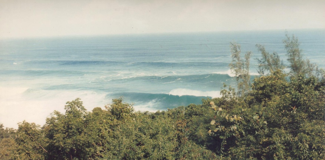
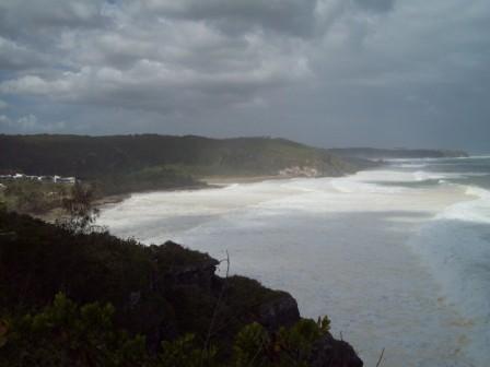
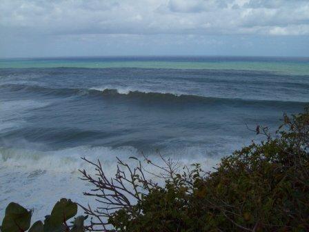
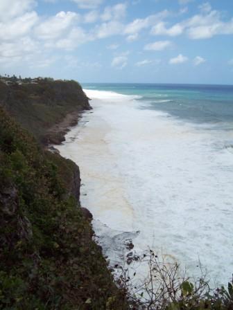
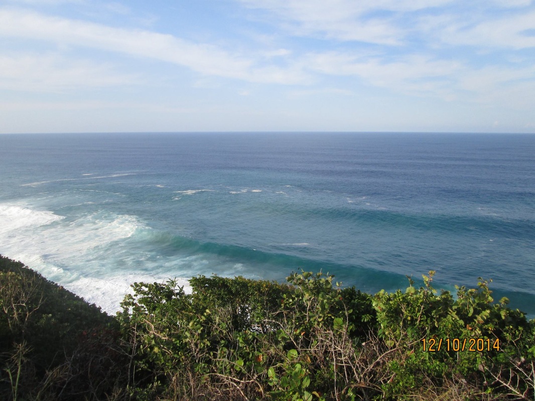
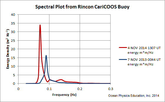
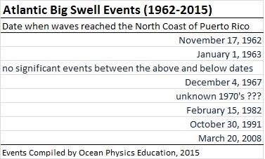
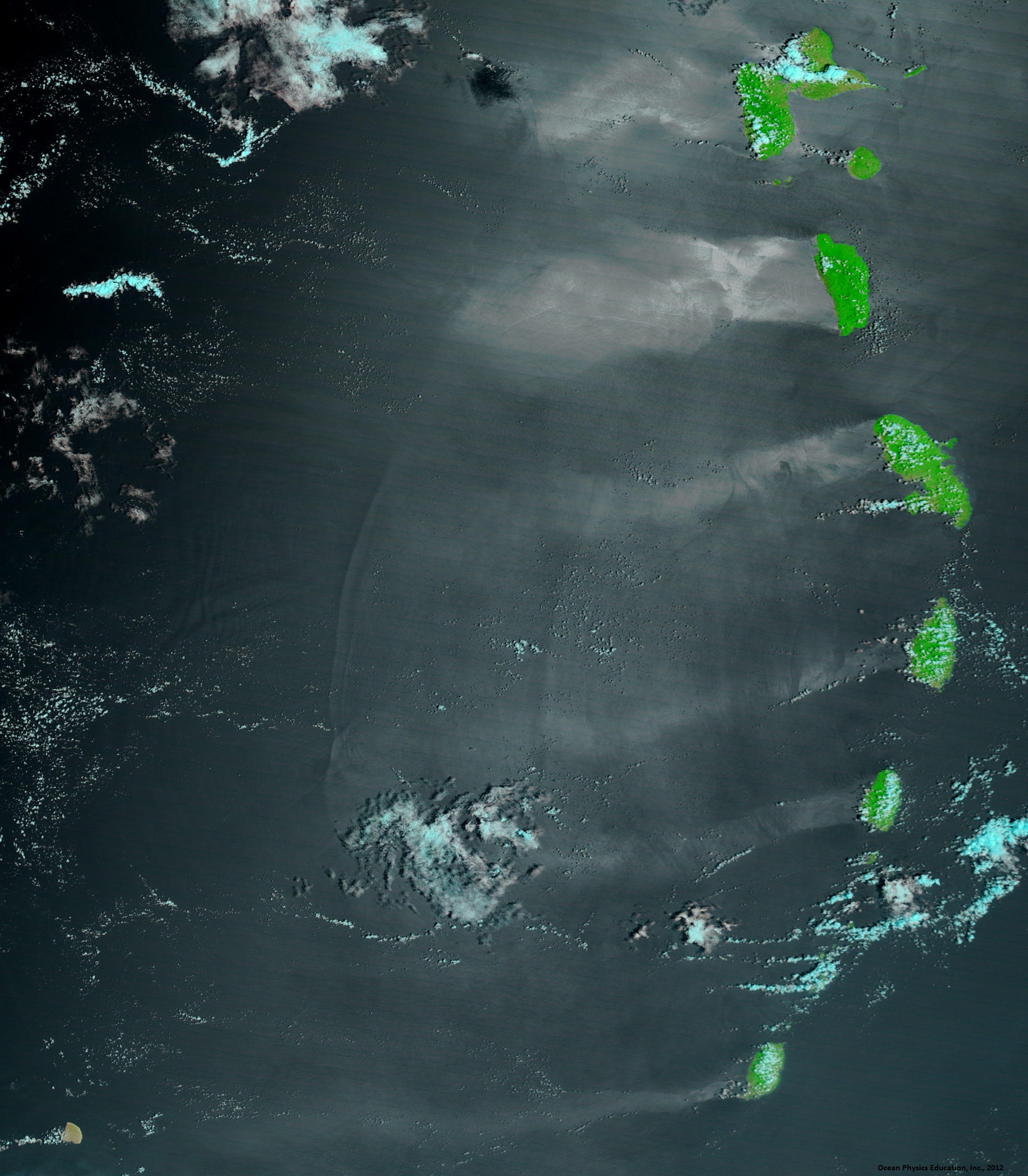
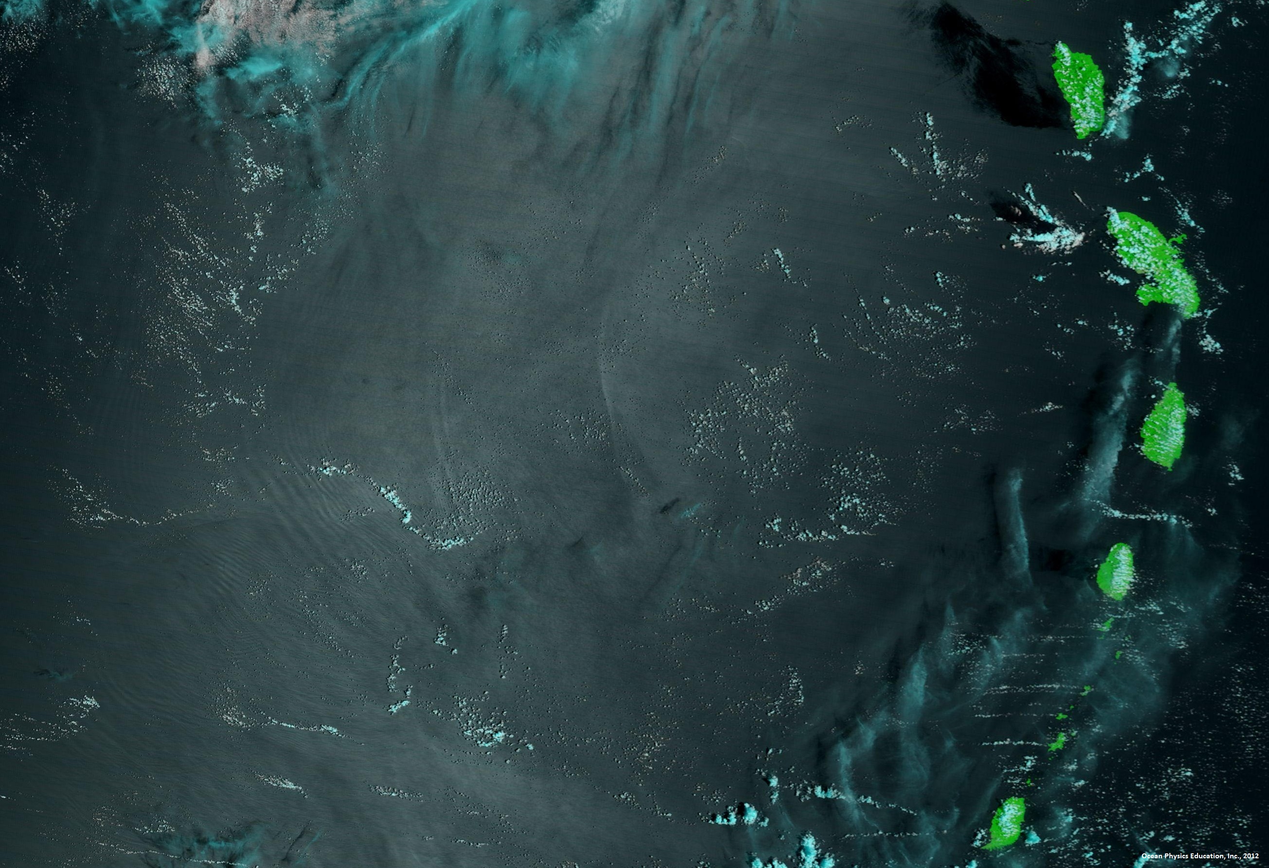
Big SWELL / MAREJADAS ALTAS
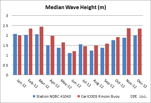
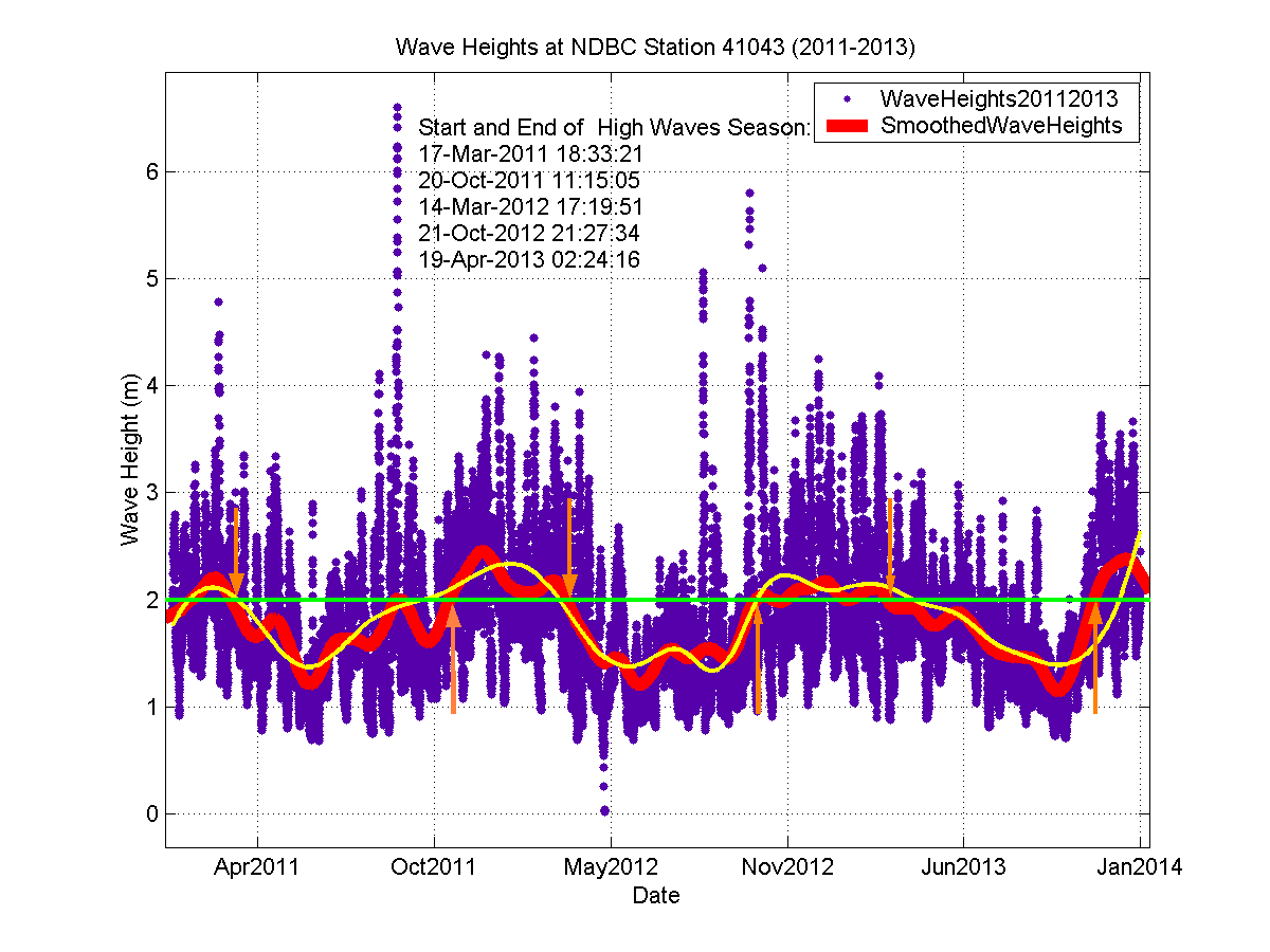
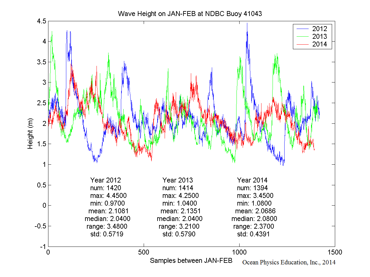
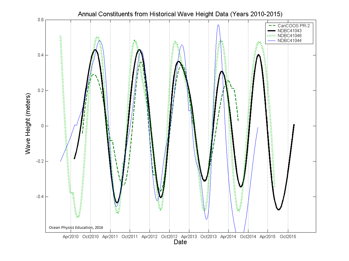
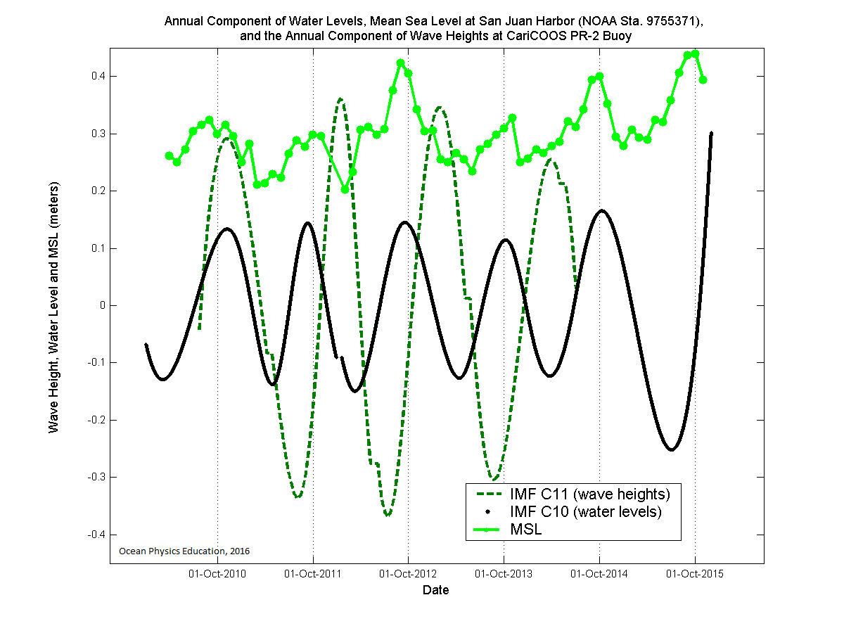
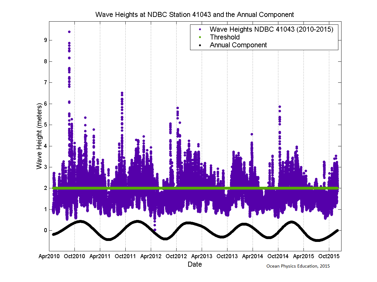
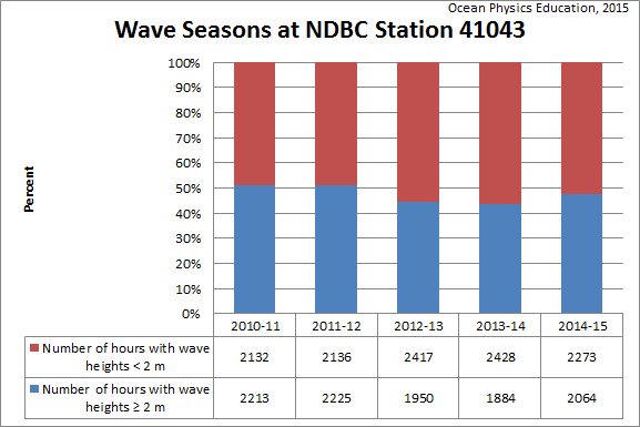
Puerto Rico Wave Climatology / CLIMATOLOGÍA del oleaje en Puerto Rico
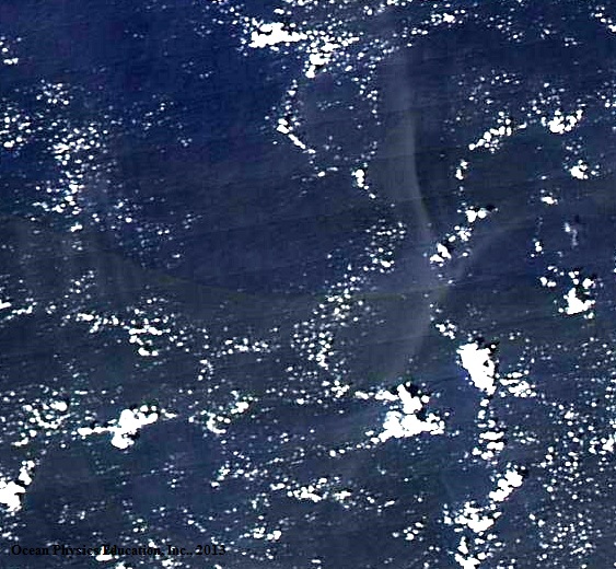
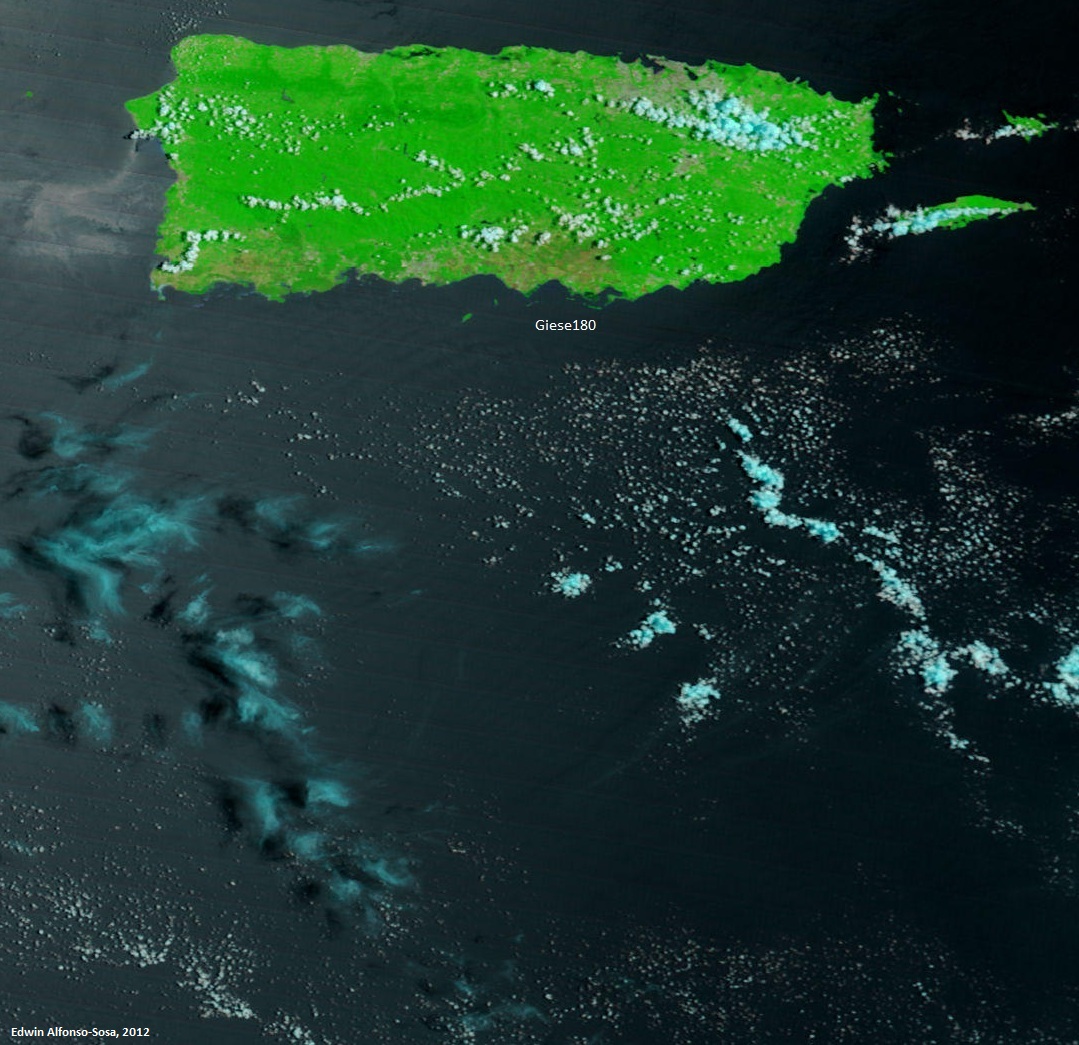
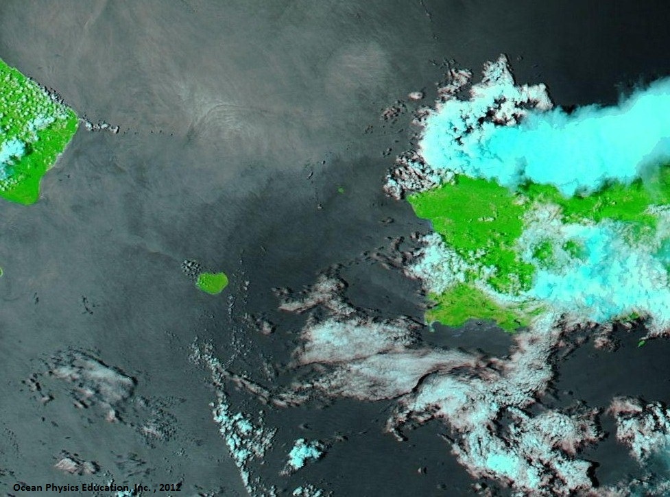
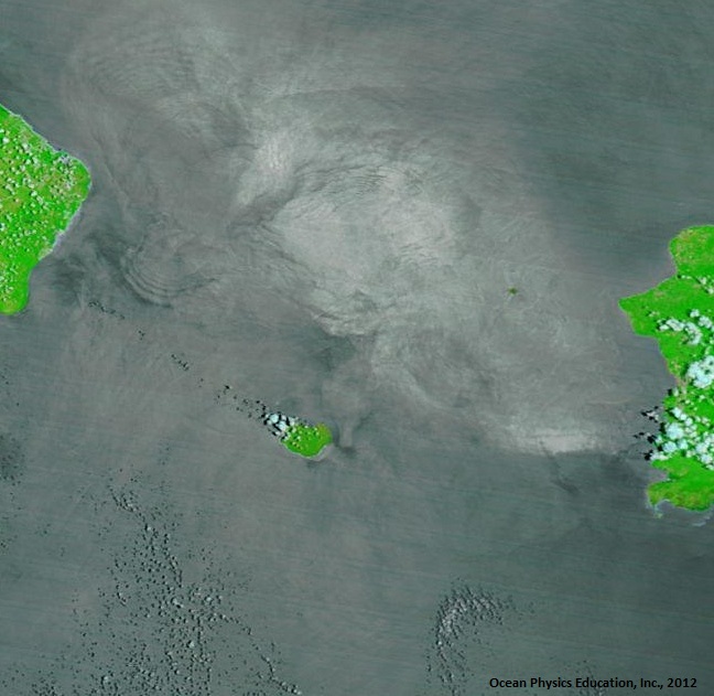
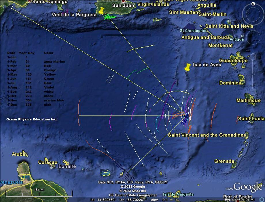
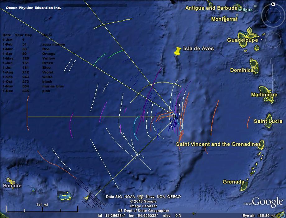
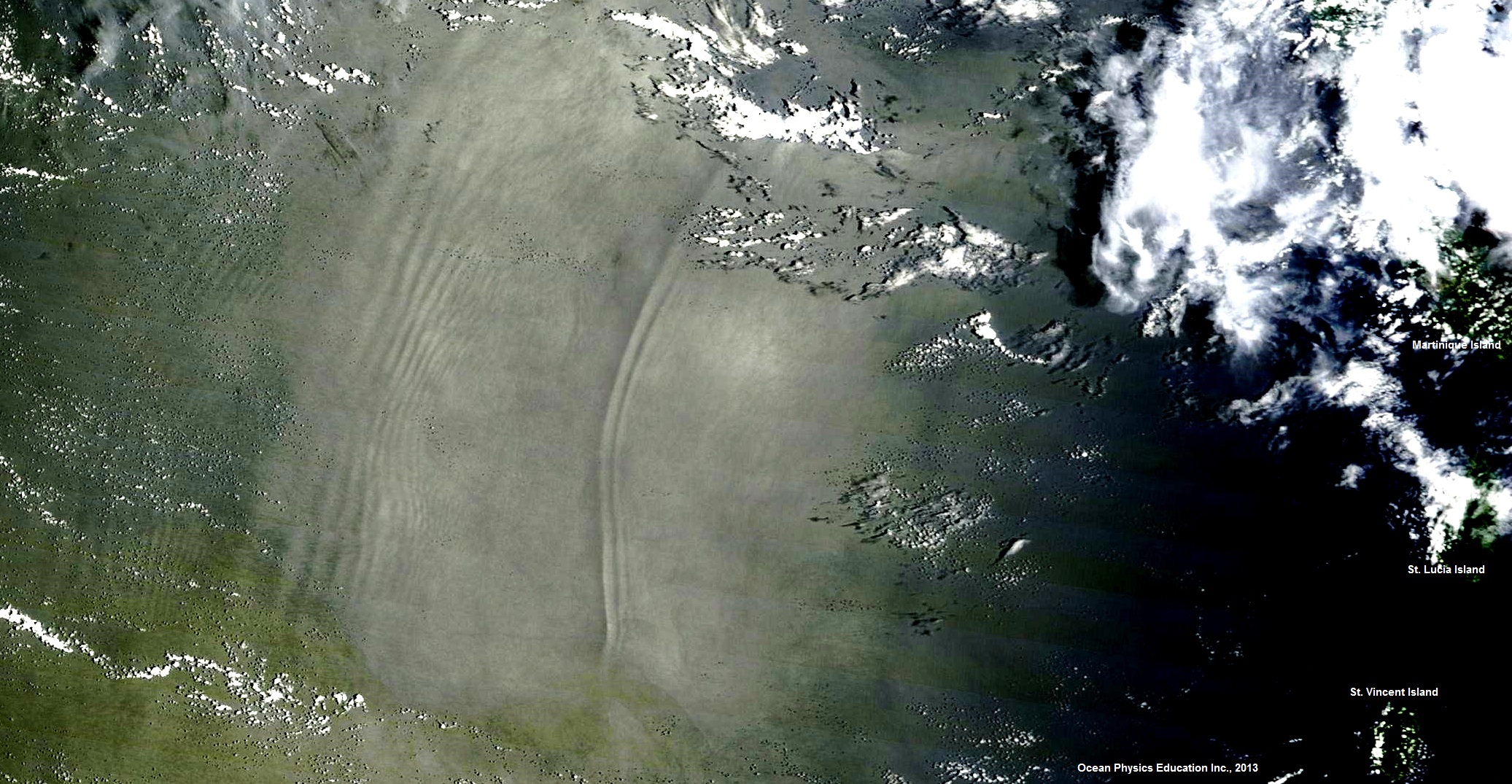
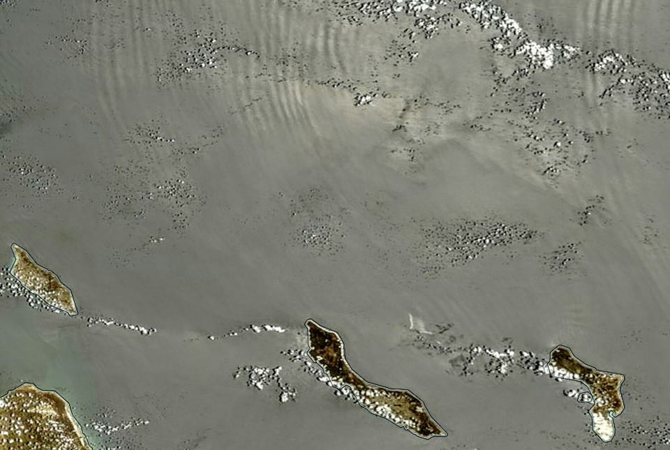
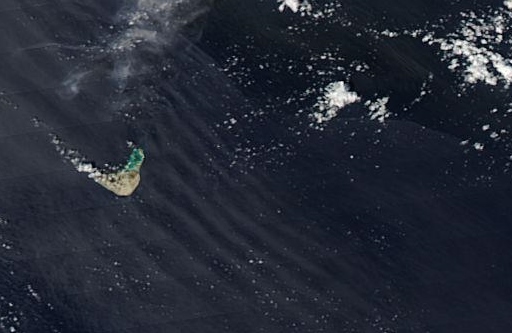
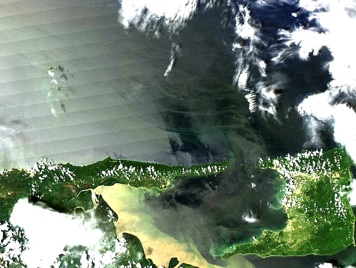
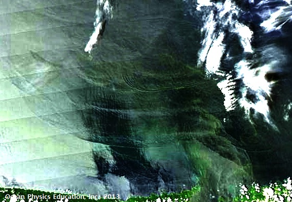
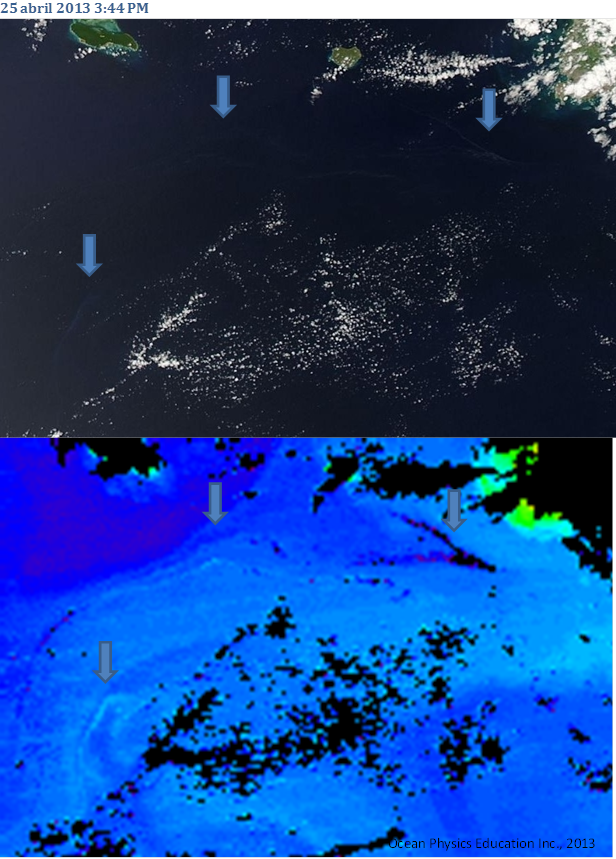
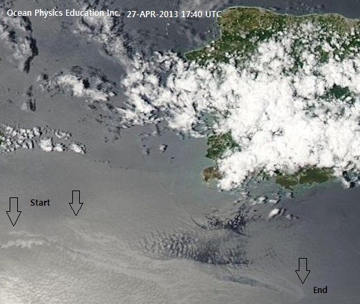
Internal Waves in the Caribbean Sea / olas internas en el Mar Caribe

|
|
|

|
|
|
|
|
|

|
|
|
|
|
|

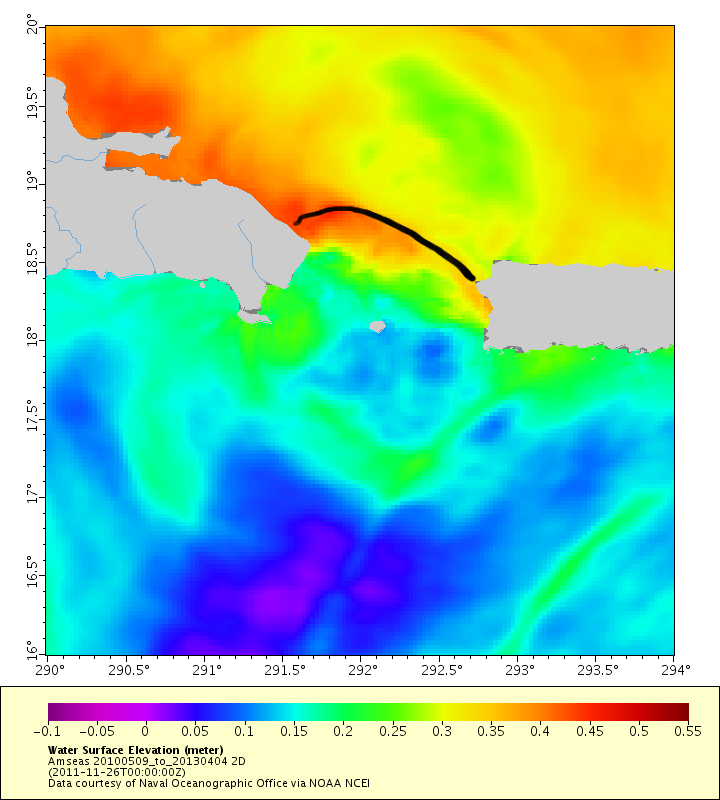
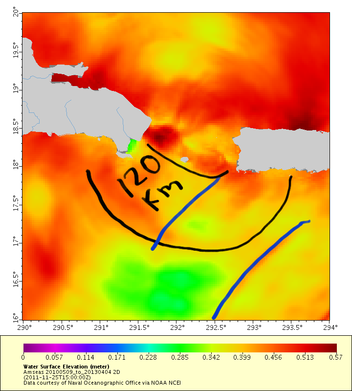
INTERNAL TIDE AT MONA PASSAGE / MAREA INTERNA EN EL CANAL DE MONA

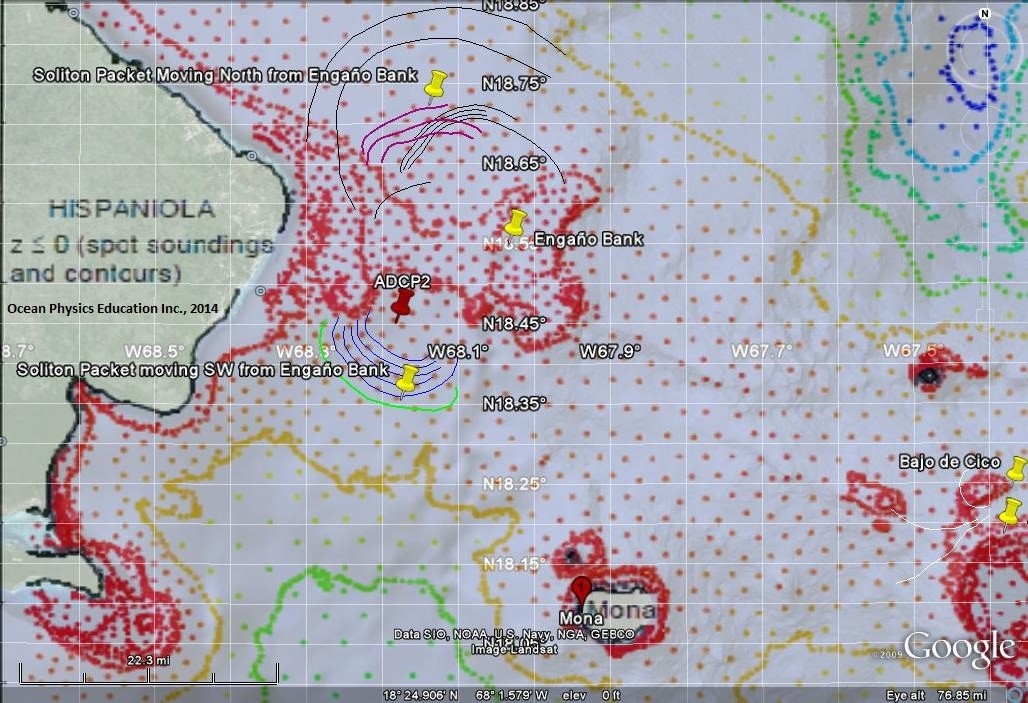
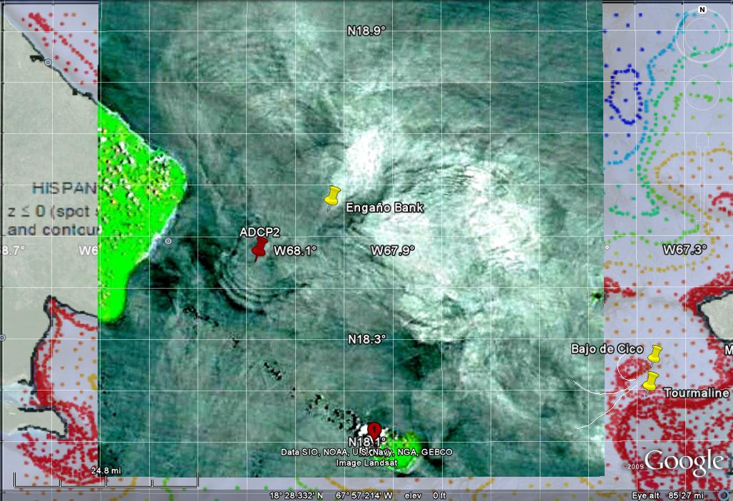
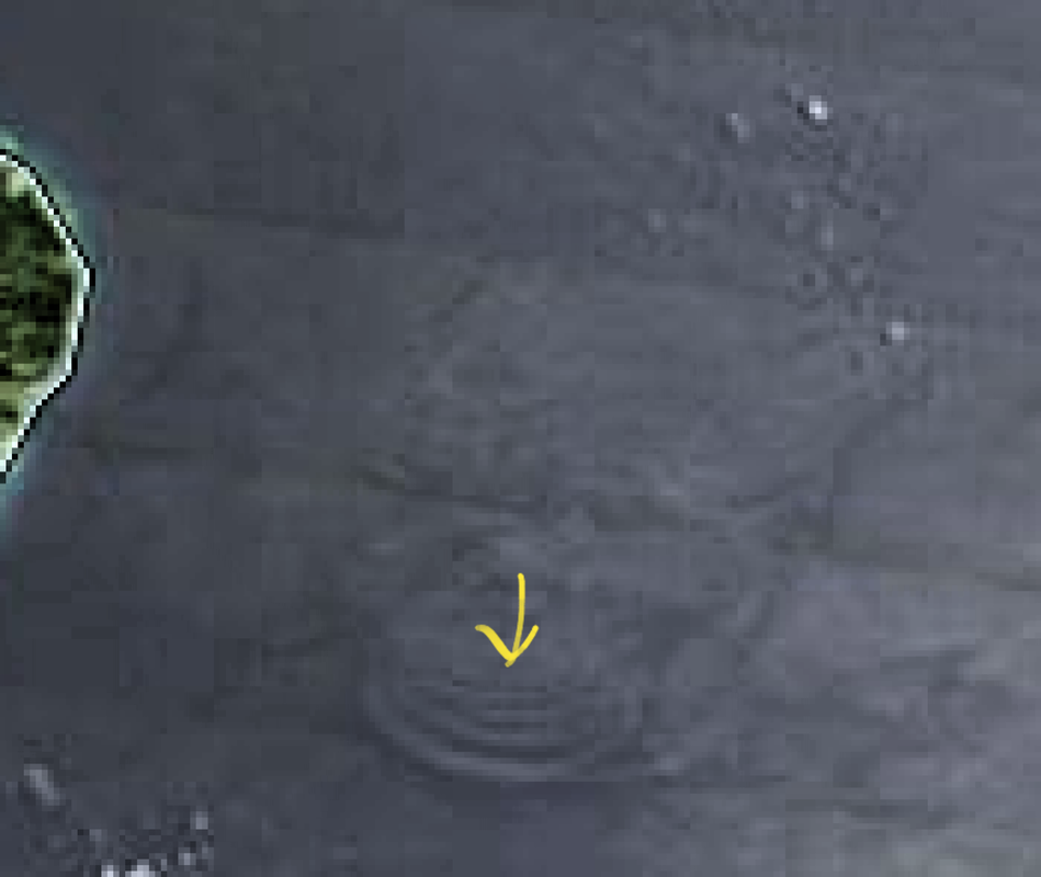
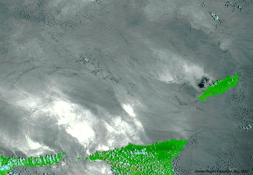
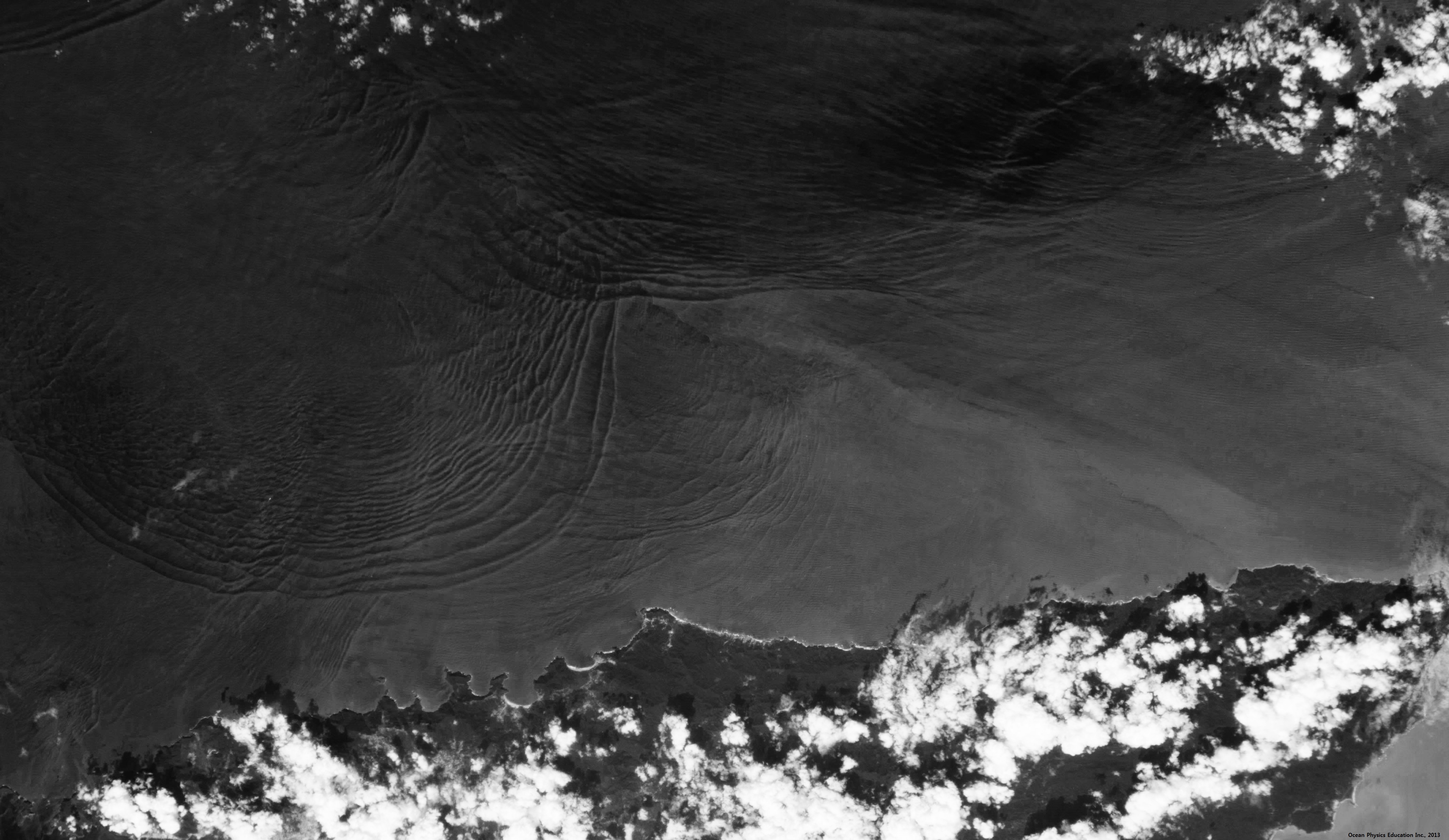
Internal solitary waves at Banco Engaño / Solitones Internos en Banco Engaño


Internal waves offshore the Peninsula of Paria and Trinidad
|
|
|
|
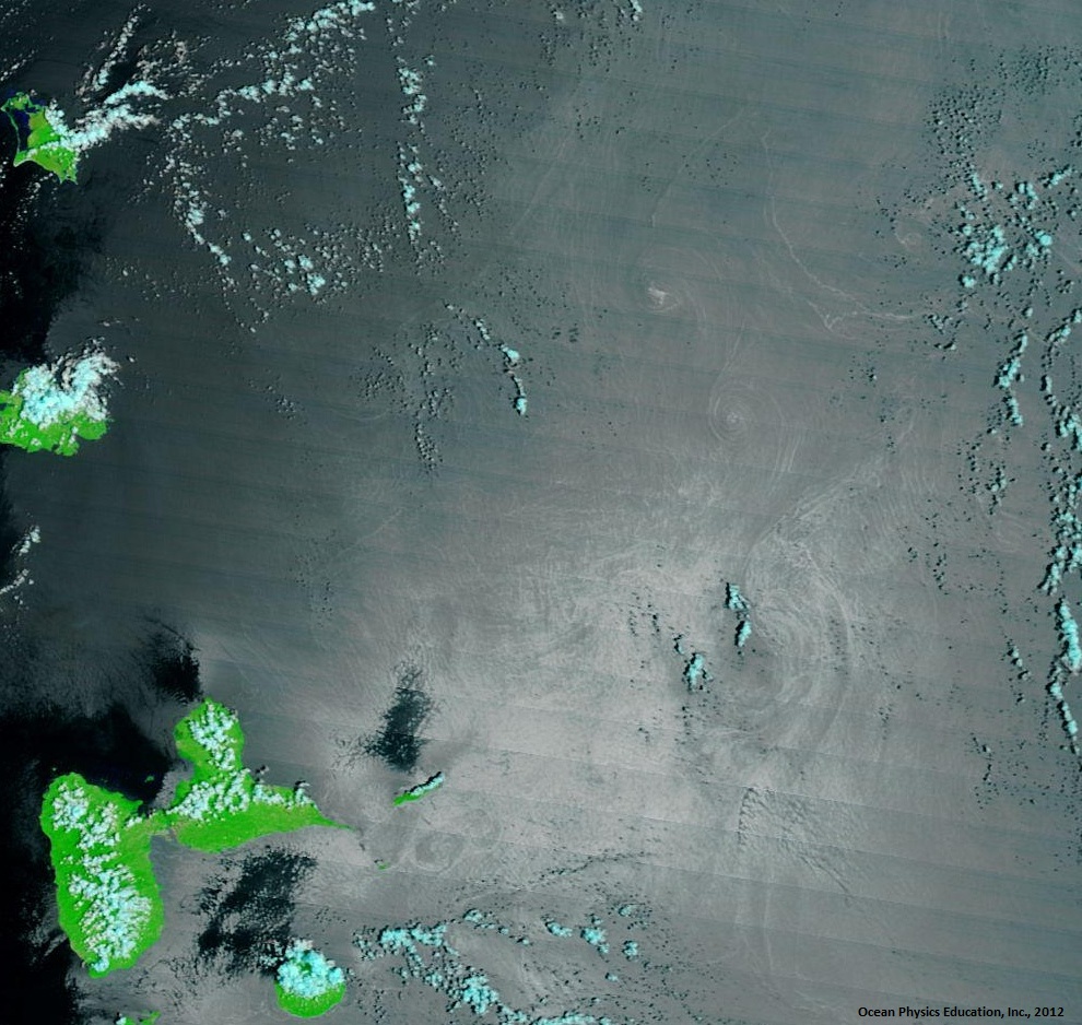
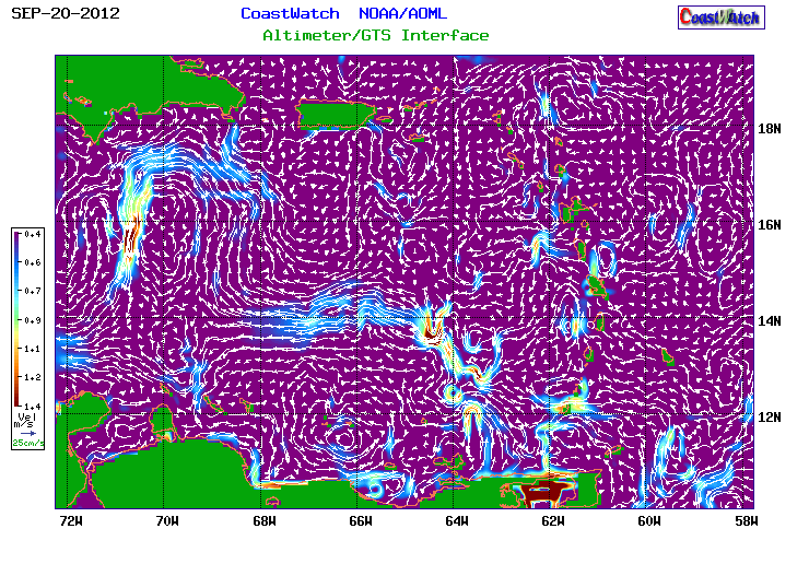
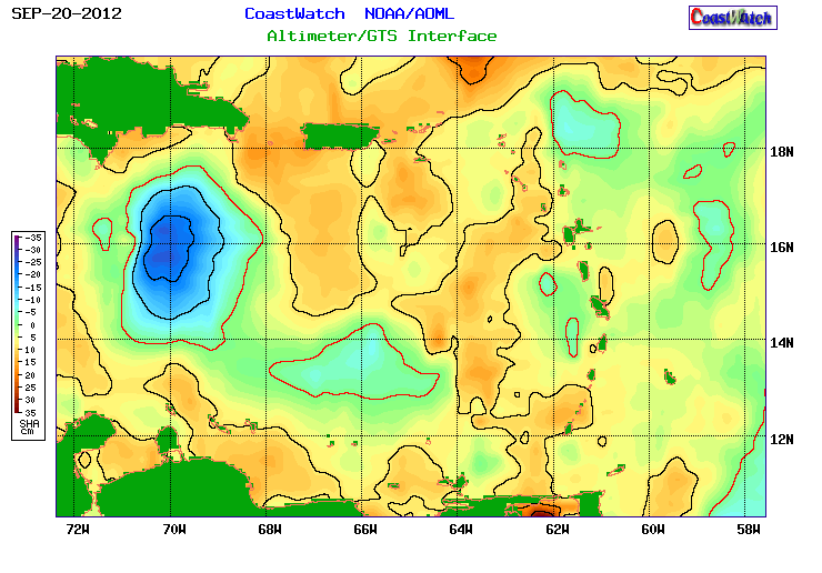
Oceanic eddies in the caribbean Sea / VóRTICES OCEáNICOS EN EL MAR CARIBE
|
|
|
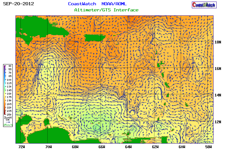
Geostrophic Currents / Corrientes Geostróficas

|
|
|
|
|
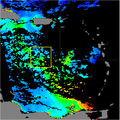
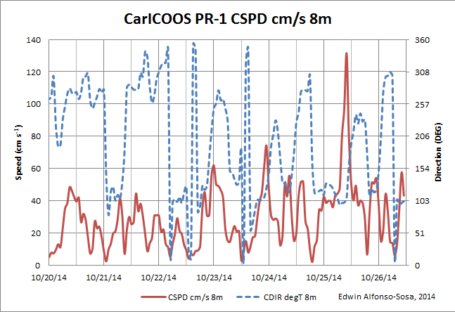
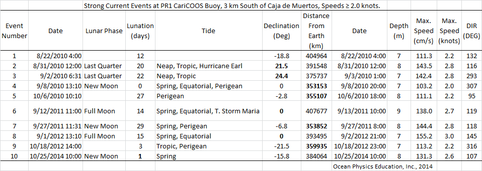
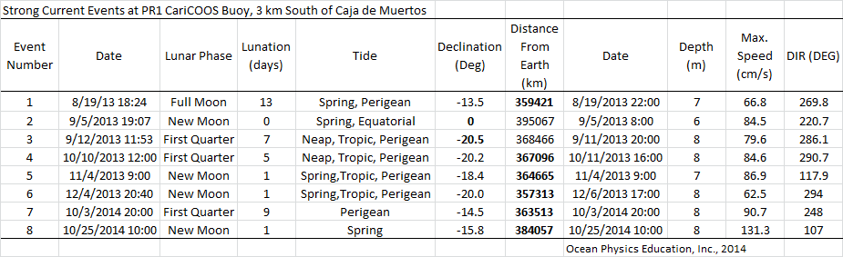
Strong Currents / Corrientes Fuertes


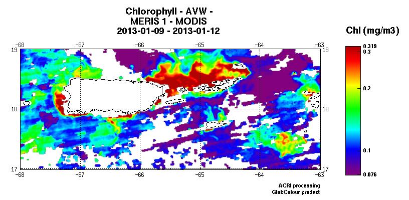
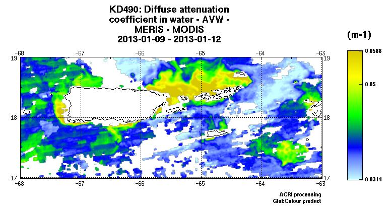
Swell Events and Strong Currents change the ocean color /
Eventos de marejadas y corrientes fuertes cambian el color del océano
|
|
|
|

|
|
|

|
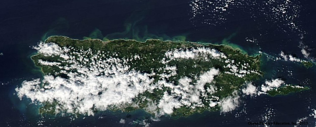
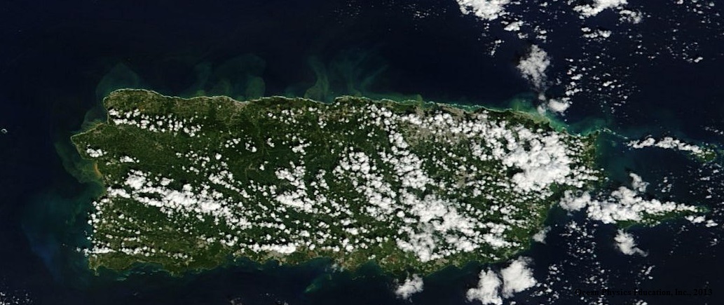
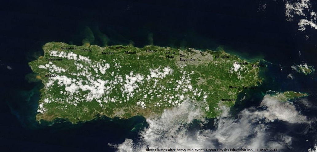
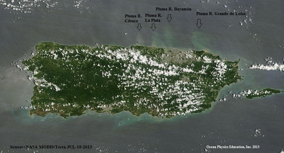
River Plume / Pluma Fluvial del Rio
|
|
|
Highest astronomical tide (hat) between 1995-2013 / Marea astronómica más Alta Entre 1995-2013
|
|
|
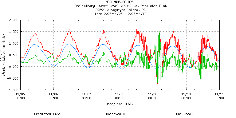
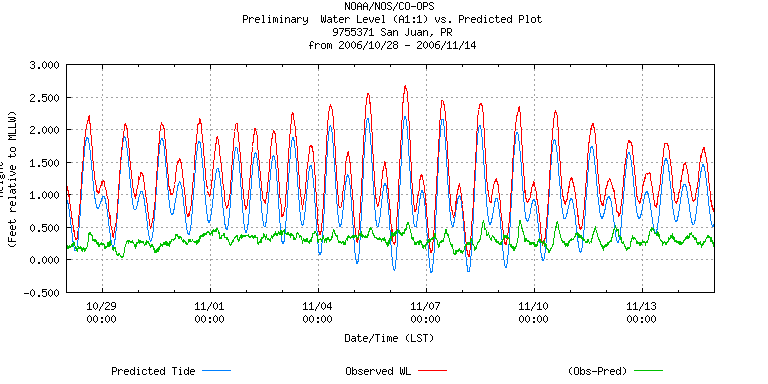
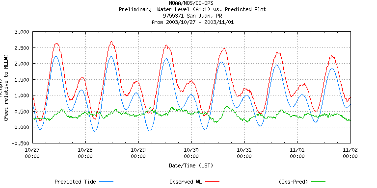
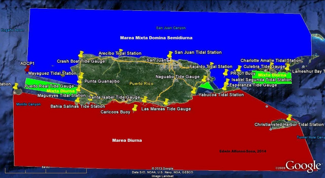
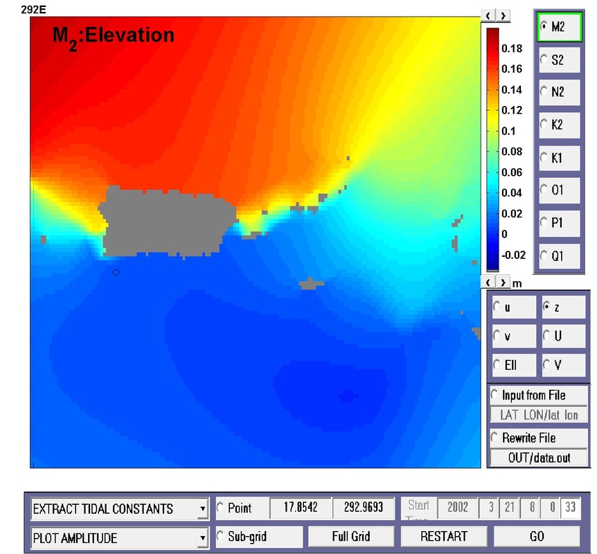
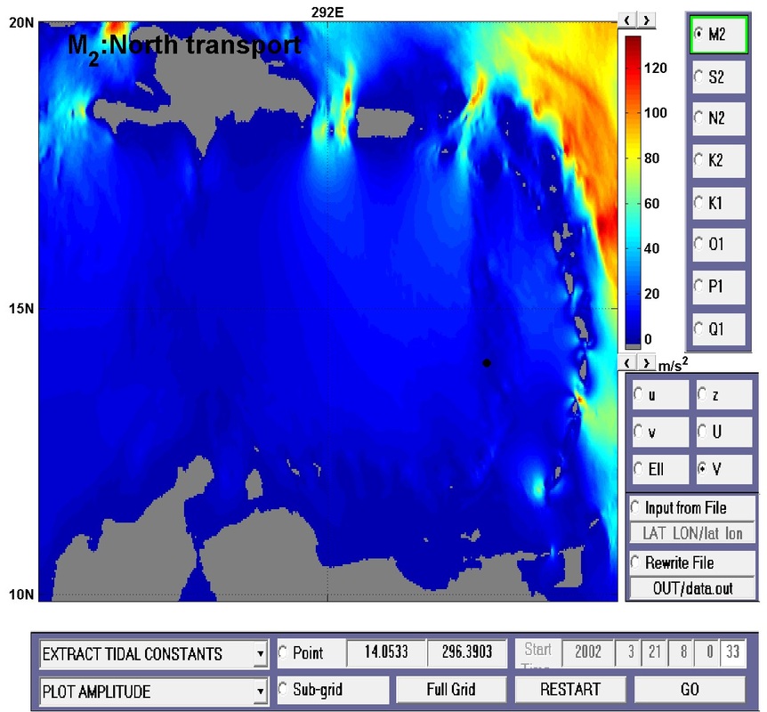
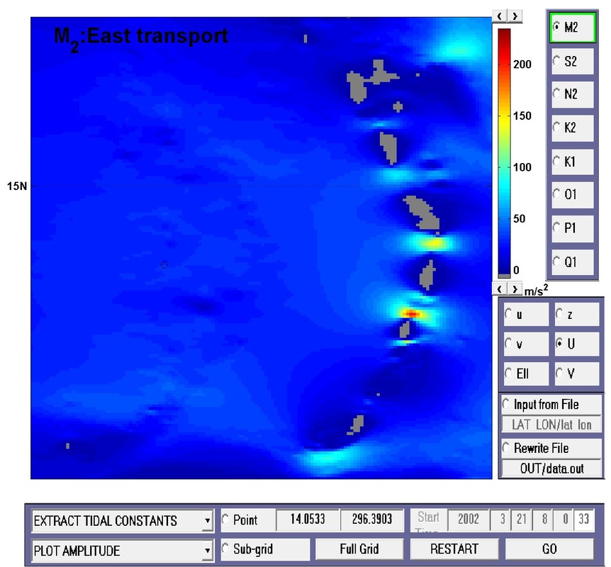
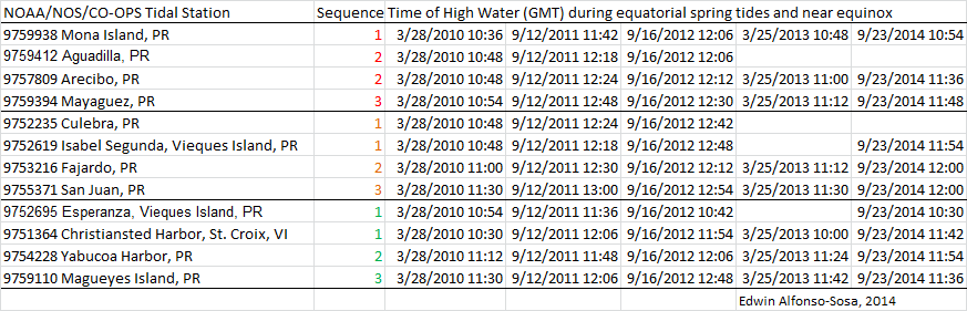
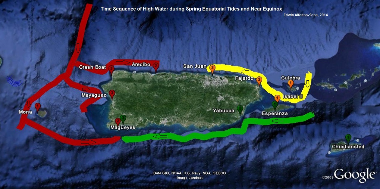
Tidal Provinces/Provincias Mareales and/y Tidal Transport/transporte mareal
|
|

|
|
|
|
|
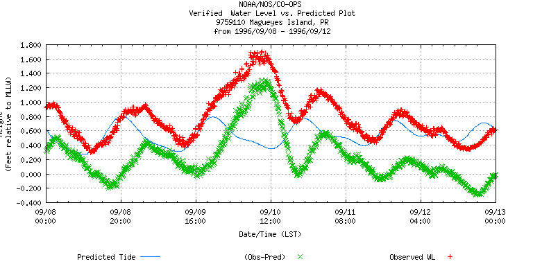
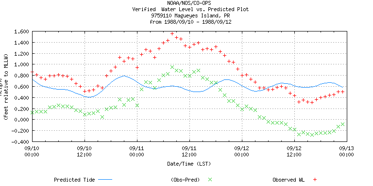
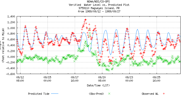
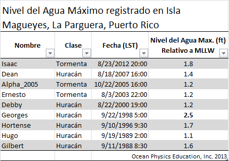
Storm Tide Events between 1988-2012 / Eventos Marea Ciclónica entre 1988-2012
|
|
|
|
|
|

|
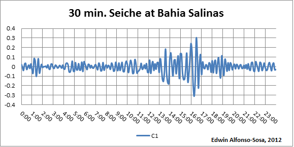
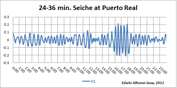
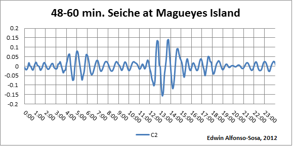
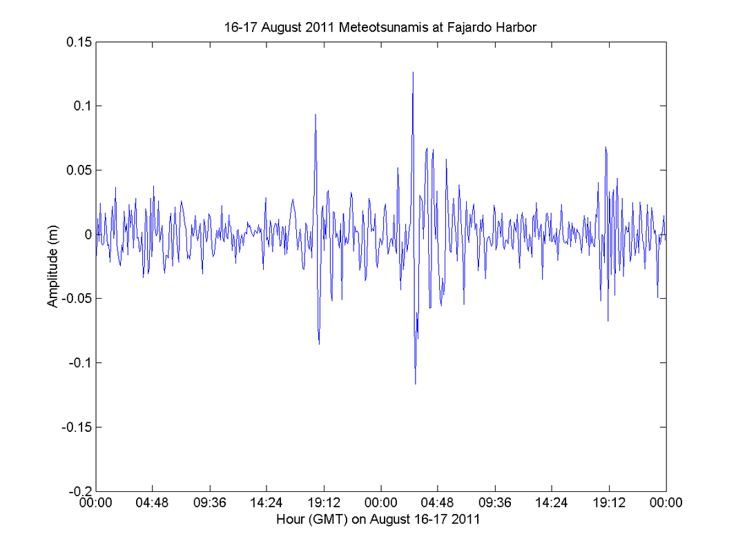
Meteotsunami aUG/16/2011
|

|
|
|

|
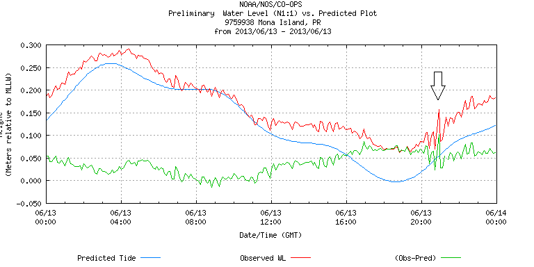
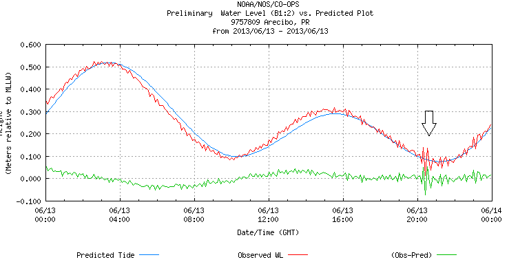
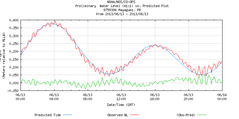
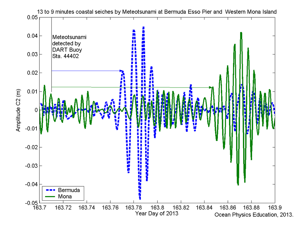
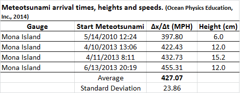
Meteotsunami jun/13/2013
|
|
|
|
|
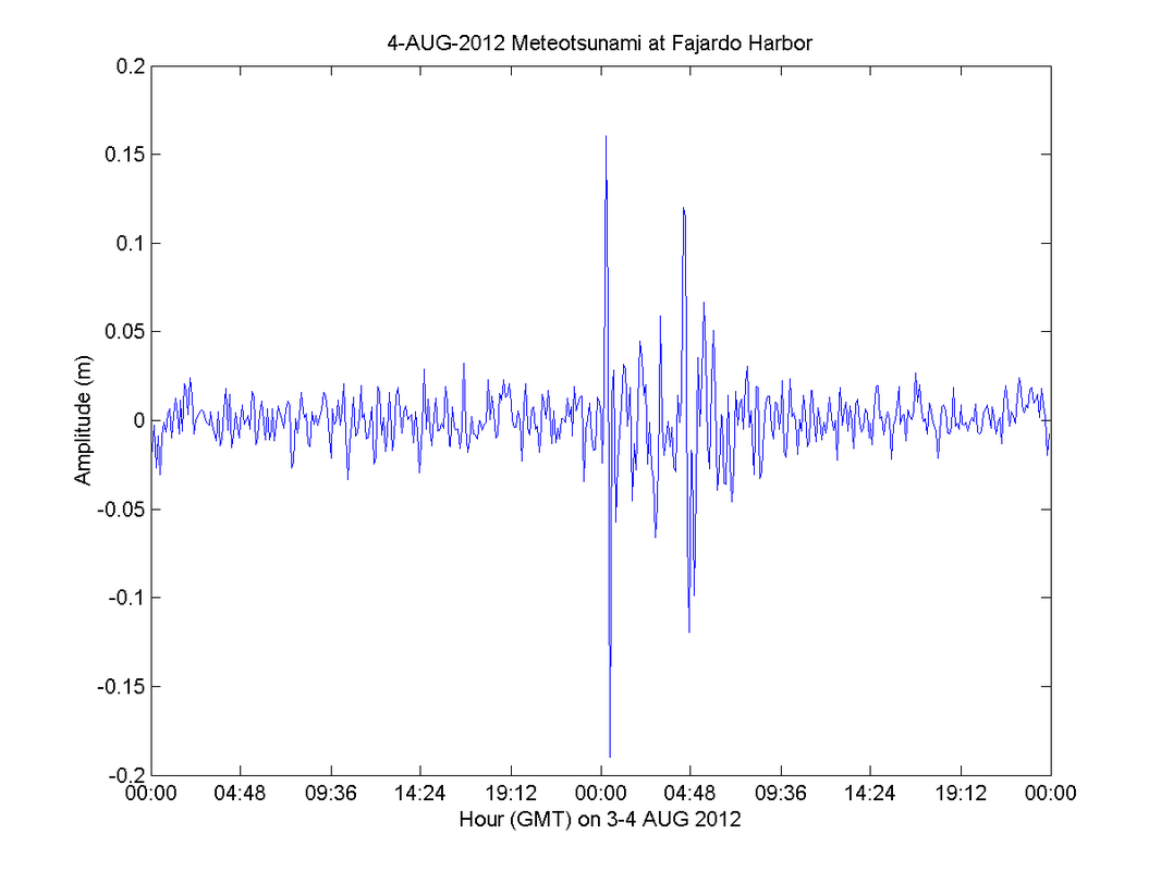
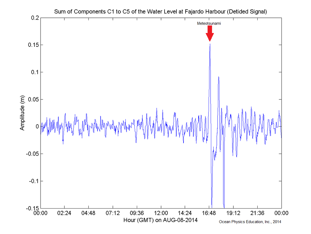
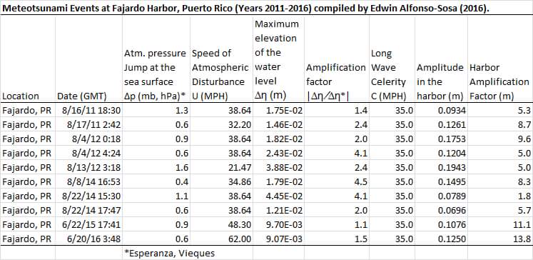
Meteotsunami en el puerto de fajardo


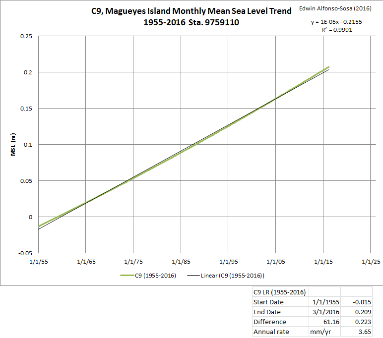
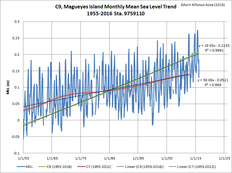
sea level Change / Cambio en el Nivel del mar
|
|

|

|
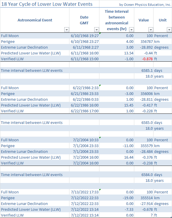
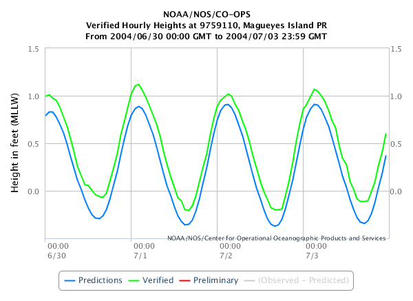
18 Year Cycle of lower low water Level events at Magueyes Island (SW Puerto Rico)
|

|
|
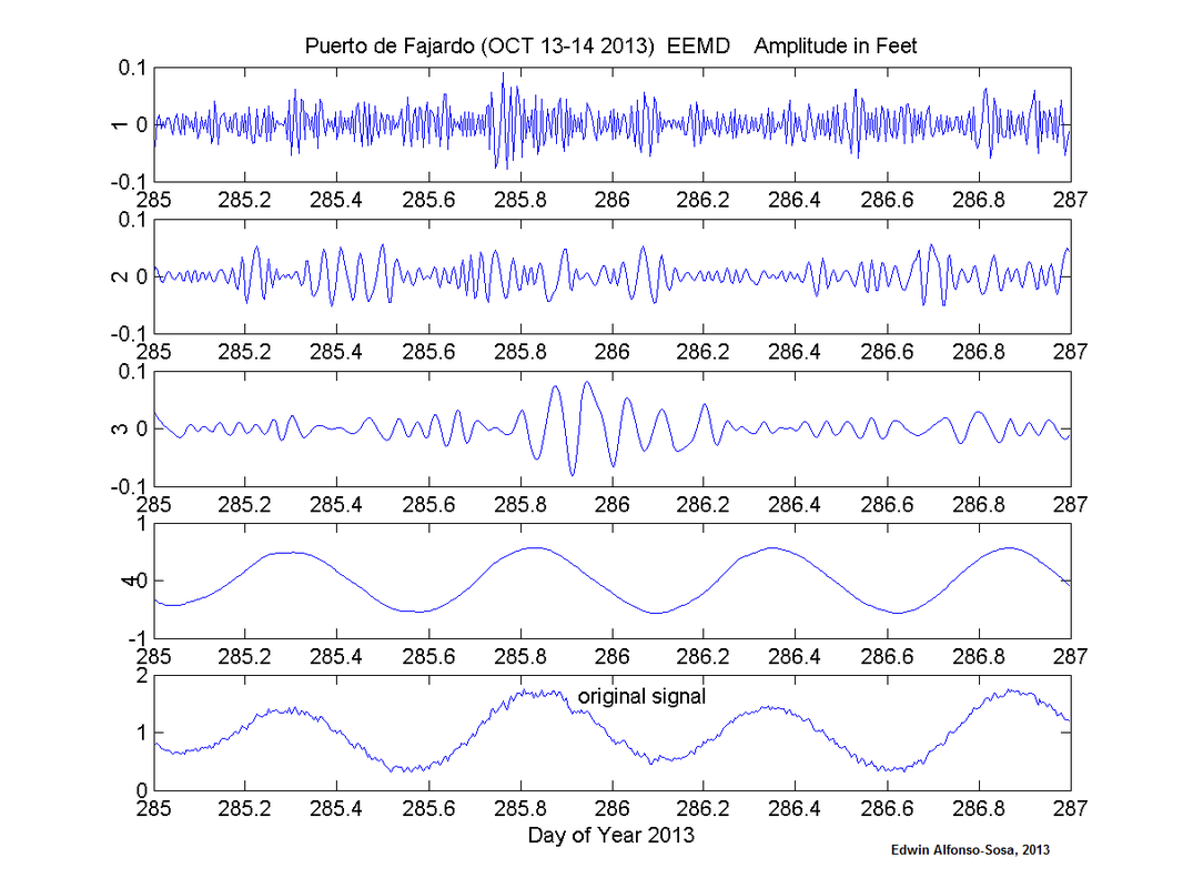
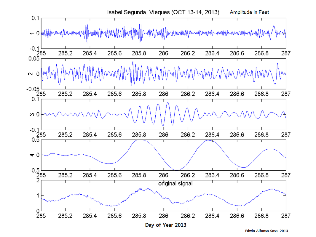
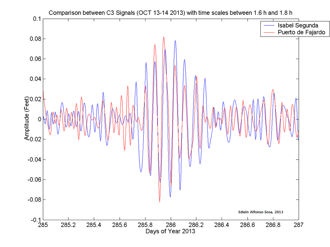
1.6-1.9 hours oscillation at Fajardo-Vieques / oscilacion de 1.6-1.9 horas en Fajardo-Vieques
EL NIÑO (ENSO) blows harder the Caribbean sea rossby whistle
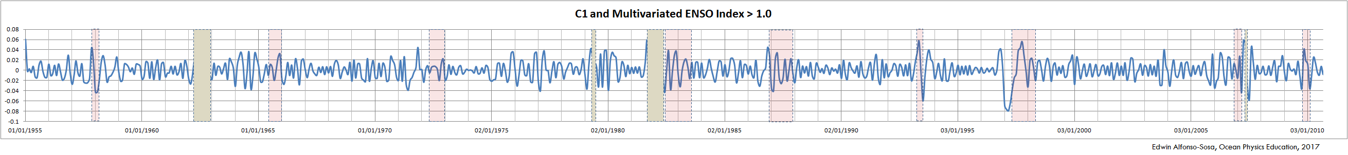
120-days coastal oscillations due to Rossby waves increased their amplitude and period during El Niño events. The red rectangles show the timespan of El Niño historic events showing a multivariate ENSO index larger than one (MEI > 1.0). The light-brown rectangles mask the time series when the original MSL data is missing. The water level data comes from Magueyes Island Tide Station maintained by NOAA/NOS/CO-OPS.
C1 is the first intrinsic mode function (IMF) from the EMD analysis of the MSL data. The analysis is shown in http://oceanphysics.weebly.com/uploads/1/1/9/5/11950137/long-period_mean_sea_level_oscillations.pdf
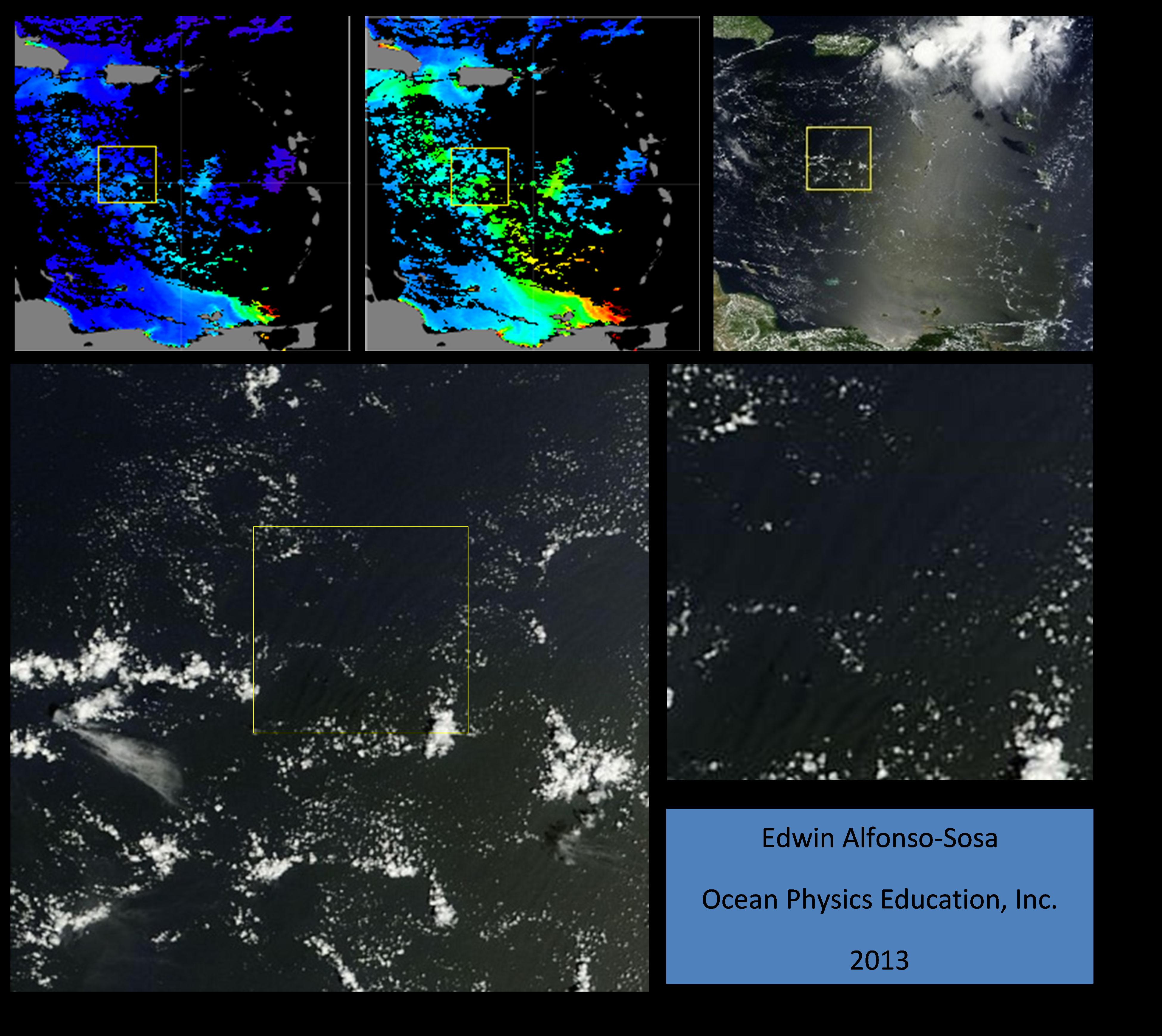
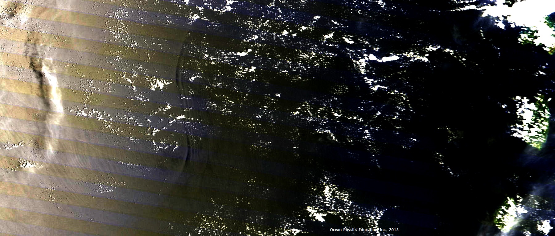
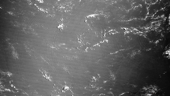
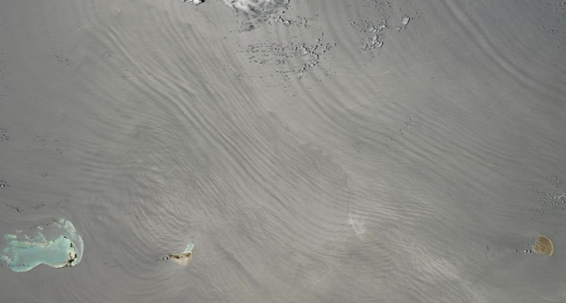
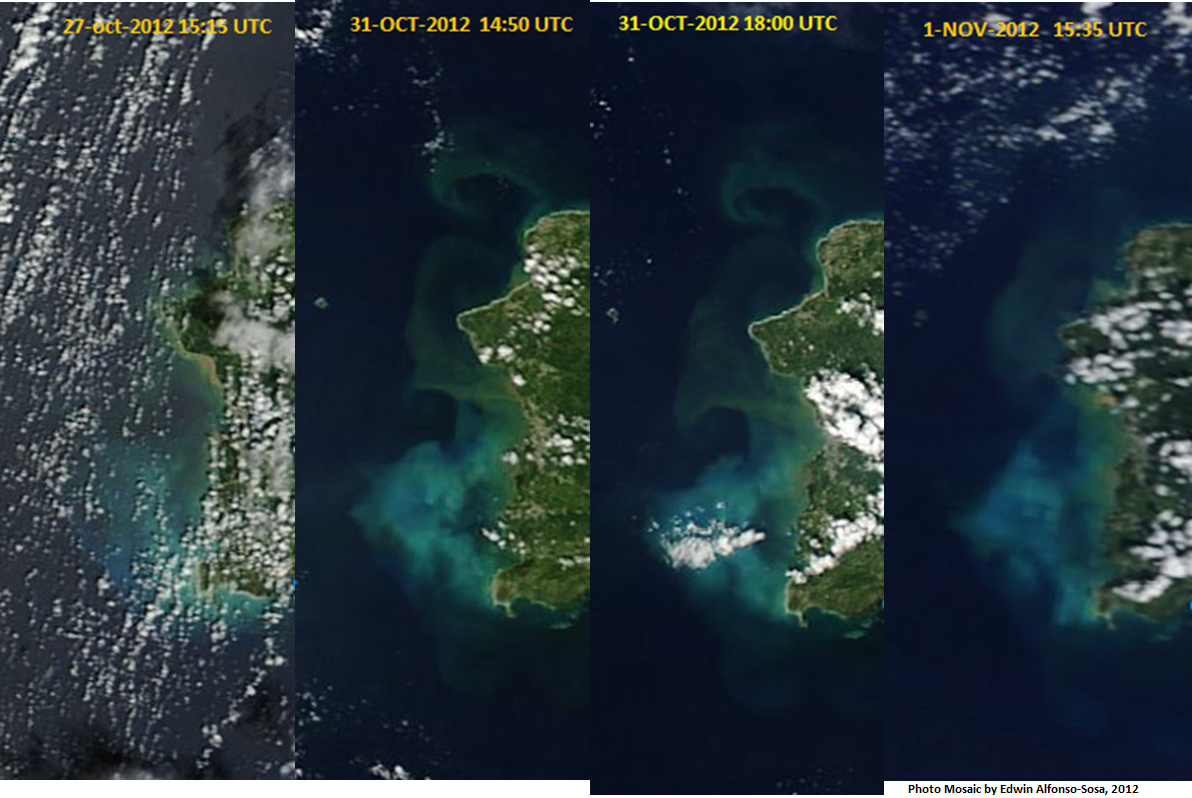
Trichodesmium bloom or Sargassum?
|
|
|
Videos
|
|
|
|
|
|
|
|
|
We acknowledge the use of data products or imagery from the Land Atmosphere Near-real time Capability for EOS (LANCE) system operated by the NASA/GSFC/Earth Science Data and Information System (ESDIS) with funding provided by NASA/HQ.
http://earthdata.nasa.gov/data/nrt-data/rapid-response/
http://earthdata.nasa.gov/data/nrt-data/rapid-response/
